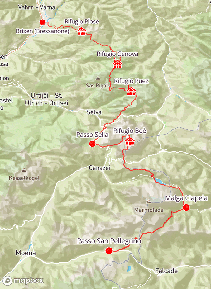
The Alta Via 2, is one of the most breathtaking routes in the Dolomites. It passes through multiple major ranges, including the Puez-Odle Nature Park, the steep rocky cliffs of the Sella group, and encircling the Marmolada - the highest peak in the Dolomites. This area of Northern Italy is a region known for its stunningly steep rocky peaks and expansive limestone plateaus.
Our route follows the main Alta Via 2 trail from Brixen (Bressanone) in the North to Passo San Pellegrino in the South, walking every step of the way over 7 days. We detour briefly from the official Alta Via 2 route around Passo Gardena to avoid 2 sections of unduly technical ground around Rifugio Pisciadu, hiking instead via Passo Sella to allow you to walk some of the best sections of the Alta Via 2 without any Via Ferrata. The Alta Via 2 is overall one of the most spectacular trails in the Alps, and our Alta Via 2: North trip makes for an unforgettable week of walking in a truly beautiful area.
Courtesy of Alpine Exploratory |